
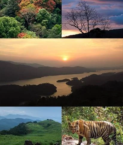
Vellari Mala, also written as Vellarimala, is a mountain region in the Western Ghats, close to Thusharagiri in Kozhikode district, Kerala. Known for its forest-covered slopes, rocky terrain, streams and cascading waterfalls, it is a destination that attracts trekkers and visitors interested in the natural landscapes of North Kerala.
The Kanjirapuzha River, a tributary of the Chaliyar, flows through the rocky landscape and creates several small cascades and scenic spots. The surrounding hills form part of the wider Vellari Mala mountain range, which extends towards Wayanad. Vavul Mala, one of the prominent peaks in this range, rises to approximately 2,339 metres.
Vellari Mala is particularly known for challenging trekking routes through forest and mountain terrain. These routes require preparation and may be subject to Forest Department permissions, guide requirements and seasonal restrictions. Visitors should confirm the currently permitted trails before planning an expedition.
For travellers searching for Vellari Mala trekking, waterfalls near Kozhikode or Western Ghats destinations in Kerala, the area offers a closer experience of the region's mountain environment. It can be explored as part of a wider nature itinerary that includes Thusharagiri and nearby hill destinations.
Vellari Mala is located in the Western Ghats near Thusharagiri in Kozhikode district, Kerala. The mountain range extends towards Wayanad, making it part of a wider highland landscape shared by the two districts.
Vellari Mala is famous for its forest-covered mountains, streams, waterfalls and challenging trekking routes. It is a recognised nature destination for people exploring the Western Ghats in Kozhikode and Wayanad.
Yes. Vellari Mala is known for trekking through rugged mountain and forest terrain. Some routes are considered challenging and may require prior permission, a guide or Forest Department supervision. Check the current rules before starting.
Vavul Mala is the highest peak in the Vellari Mala range, with an elevation of approximately 2,339 metres above sea level. It is also identified by Kerala tourism authorities as the tallest peak in the Western Ghats north of the Nilgiri Hills.
Yes. Streams flowing through the Vellari Mala mountain region form several cascades and waterfalls. The Kanjirapuzha River passes through rocky terrain, creating scenic water features along the landscape.
The drier months are generally more suitable for trekking and outdoor exploration. Heavy monsoon rain can make forest paths slippery, increase stream levels and affect access. Always check weather and local permission requirements before travelling.
Yes. Vellari Mala is located near the Thusharagiri region in Kozhikode district. Both destinations are known for their waterfalls, streams and Western Ghats scenery, although their access routes and trekking arrangements are different.
Trekking access may be controlled by the Forest Department, depending on the route and current conservation rules. Visitors should contact the relevant forest or eco-tourism office before planning a trek rather than assuming all trails are open to the public.